¡Vikidia te necesita! Actualmente tenemos 6625 artículos. ¡Anímate! |
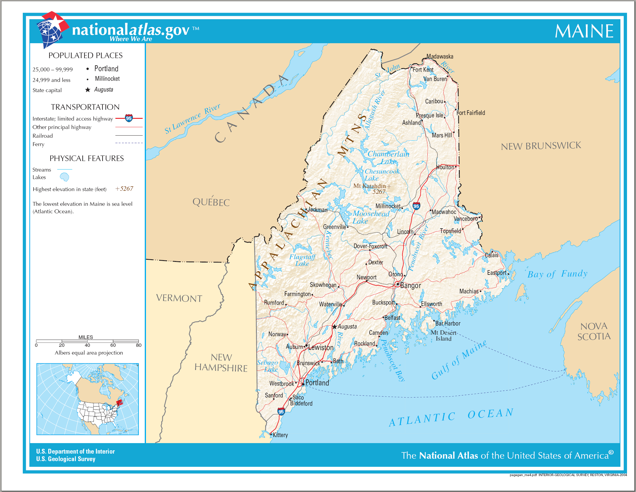
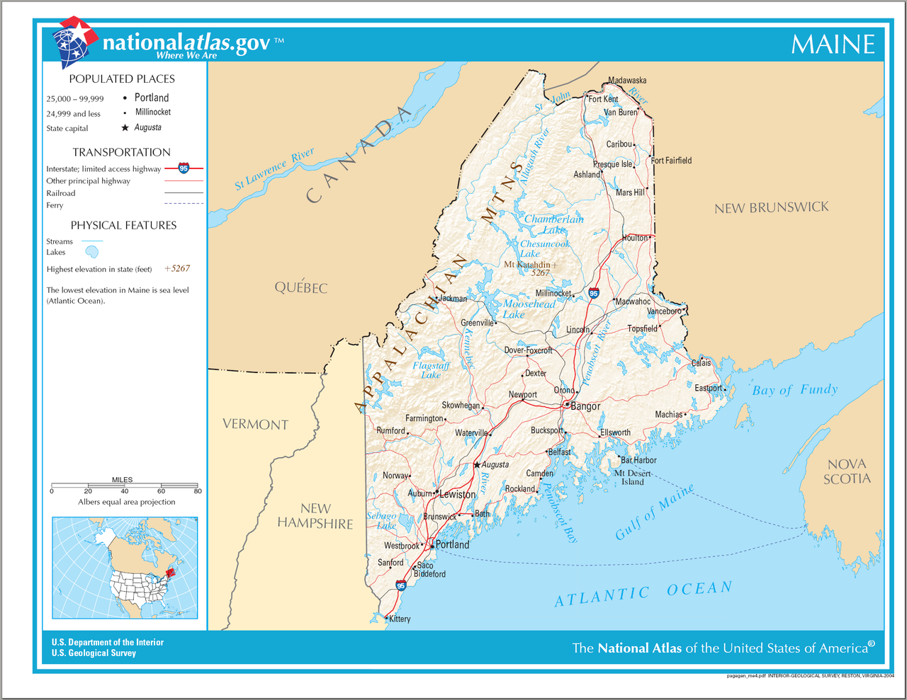
Archivo:Map of Maine NA.png
Ir a la navegación
Ir a la búsqueda

Tamaño de esta previsualización: 776 × 600 píxeles. Otras resoluciones: 311 × 240 píxeles · 621 × 480 píxeles · 994 × 768 píxeles · 1280 × 989 píxeles · 2122 × 1640 píxeles.
Archivo original (2122 × 1640 píxeles; tamaño de archivo: 1,4 MB; tipo MIME: image/png)
Resumen
| Descripción | Map of Maine |
| Fecha | |
| Fuente | National Atlas |
| Autor |
Licencia
This map was obtained from an edition of the National Atlas of the United States. Like almost all works of the U.S. federal government, works from the National Atlas are in the public domain in the United States.
Online access: NationalAtlas.gov | 1970 print edition: Library of Congress, Perry-Castañeda Library
|
Historial del archivo
Pulsa sobre una fecha/hora para ver el archivo en ese momento.
| Fecha y hora | Miniatura | Dimensiones | Usuario | Comentario | |
|---|---|---|---|---|---|
| actual | 21:02 14 ago 2006 | | 2122 × 1640 (1,4 MB) | wikimediacommons>Huebi~commonswiki | {{Information| |Description=Map of Maine |Source=[http://www.nationalatlas.gov National Atlas] }} Category:Maps of the United States Category:Maps of Maine {{PD-USGov-Atlas}} |
Usos del archivo
La siguiente página usa este archivo: